+91 7019933728/ 7760710005 ( Mon - Fri: 10:00 - 19:00 )

Pangarchulla Peak Trek

Best Seller
From₹12,500₹11,500
Best Seller
From₹12,500₹11,500
Save To Wish List

Adding item to wishlist requires an account

7516

[trustindex data-widget-id=73651e3873c884a3b48f29ef4]

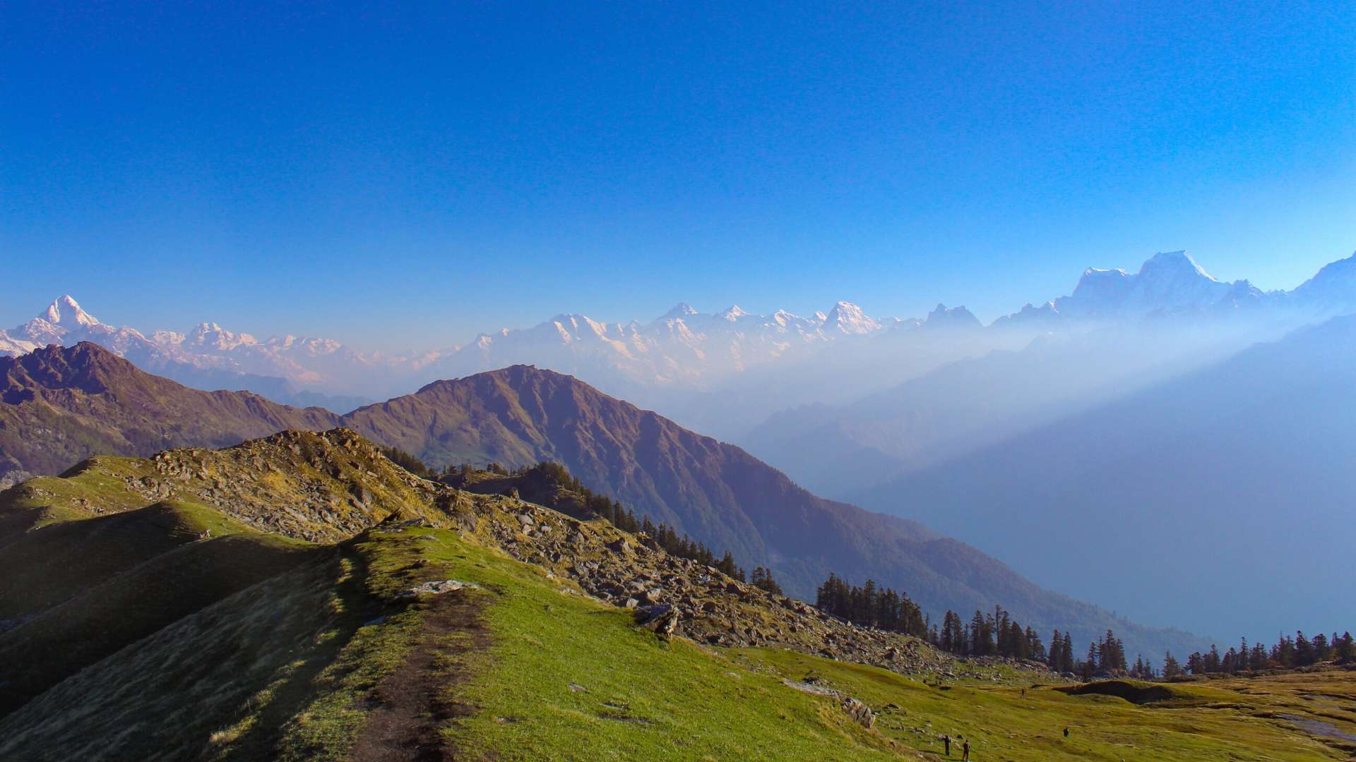
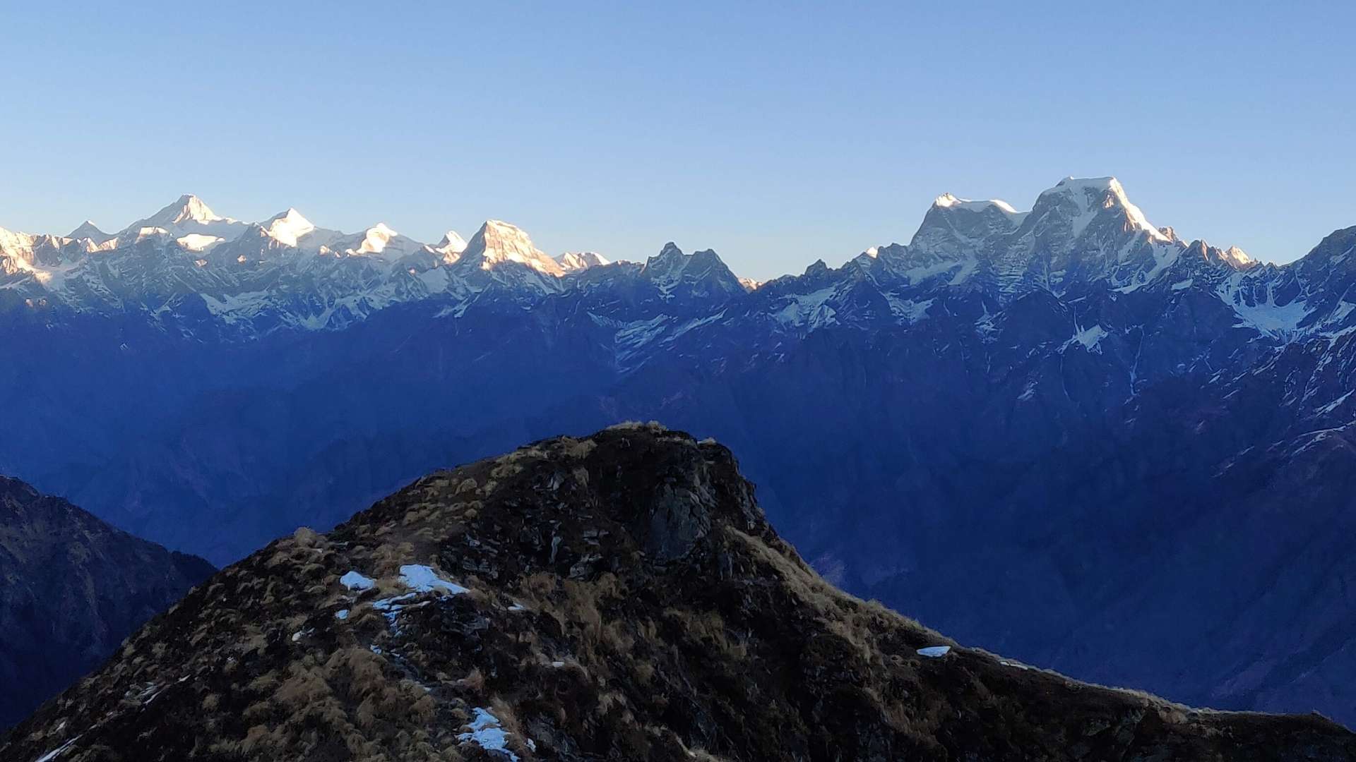
Are you excited to set out for a high-altitude Himalayan trek in the Garhwal Region? Well, the Pangarchulla Peak trek route offers you one of the most captivating high mountain views and it’s considered to be one of Garhwal Himalayas’s most celebrated treks! Resting at 14,700ft, it offers a perfect adrenaline test for mountaineering enthusiasts. We are not pumping your levels of expectation, but you will surely get to spot Nanda Devi to your northeast to all major peaks of Badrinath valley and finally stretching to Kedarnath valley peaks on the west, once you reach the summit.
Photos

Trek Details

  • Trek Region – Chamoli, Uttarakhand.
  • TrekBase Camp – Joshimath
  • Trek Duration – 6 days
  • Minimum and Maximum temperature – Day (14°C to 18°C) Night (-2°C to -5°C)
  • Maximum Altitude – 14,700 (4480 m)
  • Trek Distance – 40 kms
  • Trek Difficulty – Moderate Difficult
  • Starting point – Rishikesh
  • Ending Point – Rishikesh
  • Last ATM point – Joshimath

Pangarchulla trek - An Overview

Day 1: Drive from Rishikesh to Joshimath (6,750 ft, 280 kms drive)

Day 2: Drive from Joshimath to Tugasi (14 Kms, 45 Mins Drive) | Trek to Guling (4 Kms, 5 Hrs)

Day 3: Trek from Guling to Khullara (6 Kms, 7 Hrs)

Day 4:  Trek Pangarchulla Peak via Khullara and Back to Camp 1 ( 14,700 ft, 13 kms trek)

Day 5: Trek from Khullara to Tugasi (10 Kms, 6 Hrs) | Drive to Joshimath (14 Kms, 45 Mins Drive)

Day 6: Joshimath to Rishikesh

Price Inclusions

  • Transport: Non AC coach to and from Rishikesh
  • Accommodation: 2 Nights in a Hotel / Homestay in Joshimath on a triple sharing basis. 3 Nights Tented Accommodation on a triple sharing basis.
  • Meals: Food since arrival at Joshimath will be taken care by the Team. This includes dinner and breakfast at Joshimath on Day 1 and Day 2. Breakfast, Lunch, and Dinner will be served during the trek. The food will be vegetarian and will include occasional eggs
  • you will be staying in high quality tents and sleeping bags in all the camps. We provide high altitude sleeping bags which can stand temperatures as low as - 10? c. We also provide ropes, micro spikes, gaiters etc. As required
  • Safety Equipment: First aid, medical kit, oxygen cylinders, Stretchers etc. will be available at all campsites to deal with emergencies.
  • Mules/Porters: For carrying camping equipment like tents, carry mat, kitchen equipment, rations, etc. and vegetables
  • Kitchen staff would accompany the group
  • An Experienced Trek Leaders & experienced Local Guides
  • All trekking permits and forest camping charges are included
  • Environment levy fees
  • Experience that you gain

Price Exclusions

  • Accommodation at Dehradun
  • Rishikesh meal (Dehradun to Dhak and back)
  • Backpack offloading during the trek
  • Any meals not included above
  • Any kind of personal expenses
  • Trekking equipment like trekking bag, shoe, trekking pole or oft drinks, bottled water, beverages etc
  • Any kind of insurance (health, medical, life accidental,etc )
  • Anything not included above
  • Any additional expenses arising out of unforeseen circumstances like cancellation/roadblocks/landslides/ strike or any other natural causes out of human control or any emergency evacuation expenses.

Note: We expect our trekkers to carry their own bag, however, if someone wishes to load their trek bag on a mule or take the assistance of a porter and carry only the day backpack, an additional charge of Rs 1500 for the entire duration of the trek is applicable. Part offloading of the backpack is not allowed. One bag per trekker is accepted for offloading and the bag can not weigh more than 10 KG. We do not accept trolleys, suitcases, duffle bags or travel bags for offloading and only trek bags are accepted.


Things to Carry

  • Trekking shoes: Carry waterproof trekking shoes with good grip and ankle support. Do not carry sports shoes.
  • Three layers of warm clothes: Carry two or three-layer jackets, fleece jackets and a padded jacket.
  • Two/Three trek pants: Carry light cotton trek pants. Denim/jeans and shorts are not suitable for trekking.
  • Three t-shirts (collared/dry-fit): Full sleeved t-shirts that prevent sunburns on the neck and arms. Carry one or two dry-fit t-shirts.
  • Thermals: Carry thermals (top and bottom).
  • Sunglasses: Sunglasses are mandatory. There will be a lot of snow on the trek and can cause snow blindness.
  • Cap: At high altitude, the sun is extra harsh so carry a cap to protect yourself.
  • Waterproof hand gloves: Carry waterproof gloves and avoid woollen gloves as they will get wet if you touch snow.
  • Socks (3-4 pairs) and a pair of woollen socks: Apart from two sports socks, you can take a pair of woollen socks for the night.
  • Headlamp/LED torch: Mandatory
  • Raincoat/Ponchos: At high altitudes, snowfall and rain are quite common and it’s mandatory to carry a poncho so that you don’t get wet. The trek will continue as planned even during rainfall. Your poncho should protect you from the rain. Carry a backpack cover for extra protection from rain for your belongings.
  • Documents – ID (Driver’s License, AADHAR Card, Voter ID:: Passport and Visa copy for Foreign Nationals)
  • Day Pack ( Small Bag of 10 litres to carry necessary stuff for the day )

Pangarchulla Peak Trek - A Detailed Itinerary

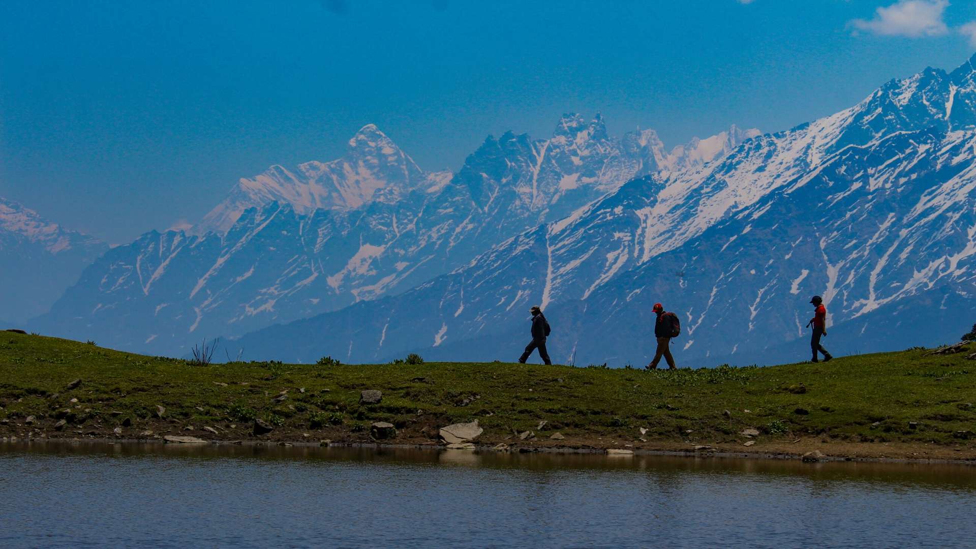
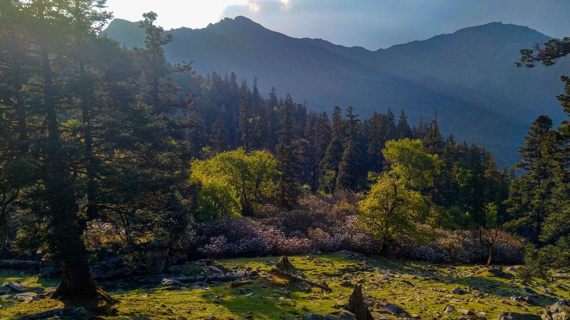
The Pangarchulla Peak (also known as ‘Chimney Peak’) Trek is one of the most breathtaking treks in India. It poses just the right amount of challenge and is ideal for hikers who want to get a taste of high altitude climbing. The peak is at 14,700 ft and can have a lot of snow till the end of May, depending upon the snowfall during the winters. The trail to Pangarchulla Peak has a variety of terrains. From lush green farms to dense jungle and then a pristine white snow-covered landscape. The views of mountain peaks like Mana, Mandir, Ghodi, Hathi, Barmal, Lampak Massif, Dronagiri, Nanda Devi can leave you completely mesmerized.
 
Moreover, this is a twin summit trek with one day reserved for Kuari Pass from where the view is further accentuated.
 
So are you ready to put on your trek shoes and join us for the adventures ahead?

Day 1: Drive from Rishikesh to Joshimath (6,750 ft, 280 kms drive)

Driving Duration: 10-11 hrs drive | Driving Distance: 254 km

Altitude: 8,790 feet

The Pangarchulla Peak Trek’s base camp is in Joshimath, and a pickup is arranged from the Rishikesh ISBT at 6 AM. Trains, buses, and taxis provide frequent service between Dehradun and Delhi. The drive through Devprayag, where the Bhagirathi and Alaknanda rivers of the River Ganga meet, will take ten hours.

The drive is exhilarating, filled with heart-pounding Himalayan roads with mountains and a deep gorge on either side. In the evening, arrive in Joshimath and check into the hotel or guesthouse where dinner and an overnight stay are planned.

Day 2: Drive from Joshimath to Tugasi (14 Kms, 45 Mins Drive) | Trek to Guling (4 Kms, 5 Hrs)

Trekking takes 6-7 hours, covering a distance of 12 km.

Gain in altitude: 2,118 ft (8,790 ft to 10,908 ft)

Moderately difficult. After a continuous 20-minute steep ascent, there are 45 minutes of gradual ascent. Steep once more for about an hour, then 1.5–2 hours of gradual and steep ascents follow.

An ascending dirt path leading away from the main road and toward Tugasi village marks the beginning of the trek. The path leading inside the village is this one. When you get to a T intersection, you must immediately turn left. The trail passes through farms and a series of level walks and gradual ascents. The mountain ridge in this area is bare and receives little to no snowfall in the winter. Watch out for the Dhauli-Ganga River as it passes the Vishnugad-Tapovan Hydro Power Station down below. With a series of steep and gradual ascents, the well-defined trail meanders along the mountain ridge. Watch for a rain shelter on the trail in the distance. The first landmark on the trail before arriving at Kharchi Village is this shelter. To get here, it takes about 20 minutes.

The trail makes a sharp right turn at the rain shelter, leaving you with the valley on your left. Ahead, you can see it swerving around the mountains. For the next 45 minutes, the trail gradually climbs while interspersed with a few switchbacks. You are taken to Lower Tugasi by it. There are numerous trails that leave from Lower Tugasi. Take the road that turns sharply to the left after passing the two water-powered flour mills.

This trail makes several switchbacks as it climbs quickly to Upper Tugasi. Here, you’ll see a lot of cultivated land, including poppy and wheat fields, as well as cultivated flowers. The streams that supply the mills below will also be visible. Since the water in these is contaminated, avoid drinking from them. Upper Tugasi will be reached in 30 to 40 minutes.

The trail continues to climb steeply from Upper Tugasi. Although the fields are behind you now, the trail is still frequently populated by villages. While on this trail, Dronagiri stands out significantly among the mountains. You’ll have to cross the final settlement in about 30 minutes. You can safely refill your water bottles at the water source you discover after the final hut.

From here, it will take 1.5 to 2 hours to get to Guling. There are both steep and easy climbs along the trail. The first oak trees start to appear 15 minutes before Guling, and you soon find yourself in a mixed forest. The trail circles the valley that you first saw when you set out from the shelter. But as you ascend, this keeps getting smaller. In the heart of the forest is the Guling campsite.

As you approach Guling, turn around. Here, Hathi and Ghora appear for the first time.

Day 3: Gulling to Khullara (11,000 ft, 6 kms)

Trek Duration: 3-4 hours | Trek Distance: 6km

Altitude Gain: 102 ft (10,908 ft to 11,010 ft)

Difficulty: Moderate. Moderate ascent all the way to Khullara.

You will receive the necessary instructions regarding the trekking trails after early morning breakfast. We will start trekking from Guling to Khullara. En route, we will have our packed lunch. Later in the evening, we will check into our campsite at Khullara base. The remainder of the day is free time. You will get to see the enchanted starry skies above as dawn breaks.
After dinner, spend the night at Khullara base camp.

Day 4: Trek to Pangarchulla Peak and back to Khullara ( 15070 ft, 13 kms trek)

Trek Duration: 12-16 hours | Trek Distance: 14 km

Altitude Gain and Loss: ⇗ 4,060 feet; ⇘ 4,060 feet(11,010 ft to 15,069 ft and back to 11,010 ft)

Difficulty: Difficult. Initial gradual ascent followed by steep ascent over snow/boulders.

Start early at 4 AM in order to reach the summit before 11 AM.

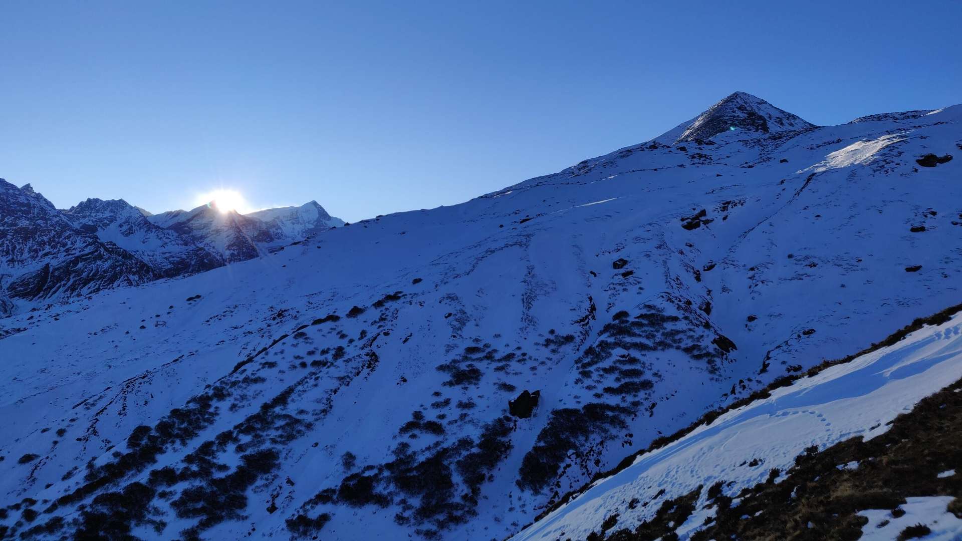
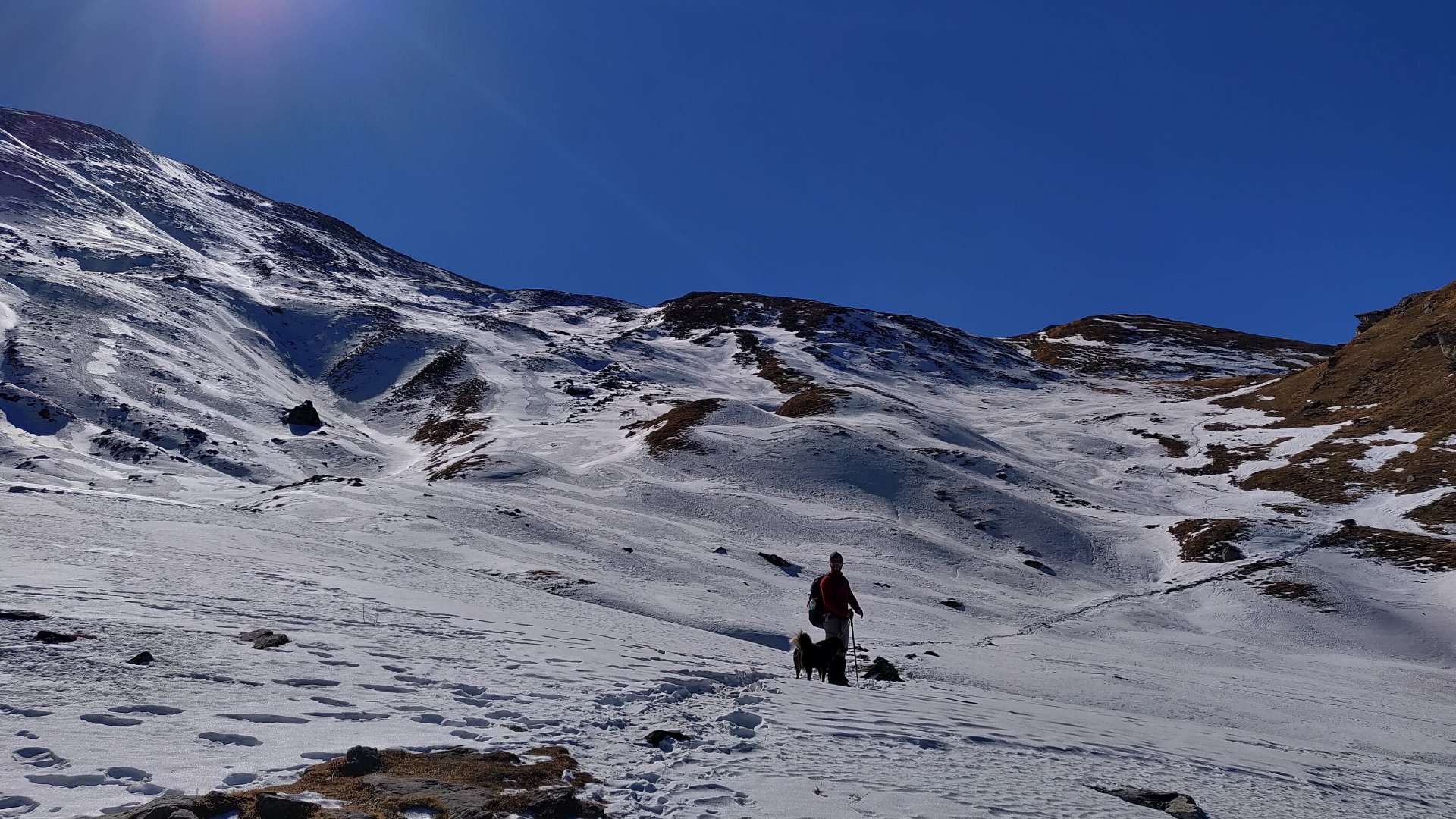
As you leave Khullara Campsite and join the renowned Lord Curzon Trail, proceed in the direction of the forest ridge up ahead. The first 30 to 45 minutes of the trek are spent along a frozen rivulet through a forest ridge. There will be a thick layer of snow covering this section. It’s a steep climb of about 100 metres. A huge snowfield will appear in front of you once you have carefully ascended the snow ridge section. Look up at the middle of the snow gully. The objective is to arrive there. Walking over the fluffy, soft snow causes the slope to become steep. The forest edge is finally behind you. Sunglasses can help prevent snow blindness.

The snow gully’s top is reached after walking for 30 to 45 minutes. You can see Pangarchulla Main and Pangarchulla subsidiary summits from here.

Stay towards the true right of the snow ridge as you walk alongside gaining altitude. From this point on, the ridge may accumulate a lot of snow during the winter (Mid January till April). You arrive at the level snow grounds after 45 minutes of cautious snow hiking along the ridge. This might serve as the Pangarchulla Summit’s advance base camp. In the winter, there isn’t any water nearby, though. Observe the Chaukhamba massifs in the far north, then Mana, Kamet, Abi Gamin, Hathi Parvat, and finally Nanda Ghunti and Trishul from this location. The Dronagiri, Changabang, and Kalanka peaks stand out in the middle sight.

Although laborious, the final ascent to the Pangarchulla summit is not difficult. To open the snow route, it is advisable to have a trained guide with you. There are multiple steep sections on soft snow. Crampons, gaiters, and proper high ankle trekking boots will aid in climbing. Crampons are highly recommended to reduce the possibility of slipping on snow. In snowy conditions, the climb’s section can take five to six hours. One can reach the summit in 4 hours during the post-monsoon season.

Watch the summit descend to the main peak of Pangarchulla from this vantage point. A total of six mountain ridges must be crossed to get to the peak’s base. The area is completely covered in snow during the winter, making it challenging to move quickly through it. Take the snow trail that leads to a level hump after a 120-meter ascent and 60-meter descent. Sharp ascents and descents make this section difficult. It’s time to climb the second snow hump after you’ve ascended the first one.

It might take an hour and a half to cross the second, third, and fourth snow ridges. Once you have a clear view of the summit climb from Pangarchulla Peak’s base, you have reached the top of the fourth ridge. As you get closer to the peak’s base, head toward the fifth ridge, which ascends gradually. The sixth ridge appears to be right nearby as you cross the fifth one.

From here to the peak’s summit, it is about 300 to 350 metres of ascent. The best way to approach the climb to the summit is to first move along the right side of the connecting ridge. Halfway through the climb, look for an appropriate point from where the summit route needs to be established. From this point on, a route must be carved out of ice using an ice axe. As you turn to face the side ridge wall with a 60-degree incline, take a left. A fixed rope might be necessary, depending on the amount of snow that has accumulated. The last section of the summit climb is at the top of the razor-sharp cornice. Here, where the wind is particularly strong, the team should be huddled on a rope. During the last ridge walk, stay off the cornice’s edge at all costs. The distance to the summit is under 100 metres. Enjoy the breathtaking 360-degree views of Garhwal peaks once you reach the summit. Nanda Ghunti, and Trishul ranges are visible from the summit for the first time.

The journey back involves a three to four-hour descent to Khullara’s campgrounds. When descending on snow, exercise caution.

Day 5: Trek from Khullara to Tugasi (10 Kms, 6 Hrs) | Drive to Joshimath (14 Kms, 45 Mins Drive)

After early-morning breakfast, there will be a briefing with all the information you need about the remainder of the trek starting from Khullara, we will trek to Tugasi Village. We will eat our lunch on the way. We’ll begin the drive to Joshimath once we get to Tugasi. We will have dinner and spend the night at the designated homestay in Joshimath.

Day 6: Drive back to Rishikesh

After we have breakfast, we will be leaving our hotel. From Joshimath, we will travel to Rishikesh by car. Dev Prayag, Rudra Prayag, and Karn Prayag are just a few of the Prayags with beautiful scenery. As soon as they get to Rishikesh, the group will break up and go their separate ways, but not without sharing many memorable experiences together.

The Tour Comes to an End Here.

FAQ

I'm a solo traveller, Can I join?

The interesting thing about traveling alone is that you get to meet new people from  diverse backgrounds, and towards the end you are no longer strangers. Hence solo travelers are always welcome to join us on our trips. Read more about solo travelling here and get inspired! https://www.plantheunplanned.com/solo-yet-accompanied/ 

Is it safe for Women/Girls?

Safety and security is our priority at all times. Hence it is absolutely safe for women/girls to join us on our treks and travels. Our trek leaders accompany the team at all times, and our campsites are secured and safe for accomodation. We also have female trek leaders who accompany on most of our treks.


What will be the group size?

Usually, we take maximum of 15-18 people in one group. We believe bigger groups have less fun and less coordination so that’s why we prefer smaller groups.

We need at least 4 people to operate our fixed departure tours/treks.

How do I avail discounts? 

Details for availing  discounts are mentioned in the following link, https://www.plantheunplanned.com/membership/

What is cancellation policy?

Here’s the cancellation policy for Himalayan Treks/Backpacking Trips/Road Trips

  • If you cancel before 30 days – 90% of amount will be refunded
  • If you cancel between 20 -30 days – 75% % of amount will be refunded
  • If you cancel between 15-19 days – 50%  will be refunded
  • If you cancel between 7-14 days – 25 % amount will be refunded
  • If you cancel between 0- 7 days before the departure date – No amount would be refunded.

Note: For All The Above Refund Cases Transaction Fees/Internet Handling Charges will be dedcuted from the overall amount and balance amount shall be refunded. You can transfer your ticket to anyone so that you could save your hard earned money

For other trips and travels with us, and detailed terms and conditions check the      following link : https://www.plantheunplanned.com/refund-cancellation-policy

Notes

  • Consumption of alcohol, intoxicants, and smoking would not be tolerated during the entire course of the journey. Kindly co-operate with us to make the experience more fun.
  • Put Litter in its place, do not trash the mother earth.
  • In the case of traffic delays or breakdowns expect a few delays in reaching the destination.
  • All the meals will be Veg if included
  • Plan The Unplanned will not be responsible for any loss/ hamper of your possessions. We request you to be alert about whatever you carry.
0
0
0